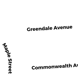
26 HARVARD ST
Owner Information
MCGILLICUDDY MARY M
26 HARVARD ST
MARLBOROUGH, MA 01752


Property Details
26 HARVARD ST is classified as a Single Family Residential (Colonial).
The primary structure on this property was built in 1979. There are 2,688ft2 of built area within this property. There is 1,632ft2 of residential/living space within this property. This property is listed as having 7 rooms.
26 HARVARD ST is valued at $376,300. The land is valued at $121,700 and the structures are valued at $249,800. There is an additional valuation of $4,800 on this property.
This property is in Zone RB. Confirm with local Zoning Board authorities to ensure there are no overlays or other easements on this property.
The most recent deed for 26 HARVARD ST is recorded at the local registrar in Book 63366, Page 095. 26 HARVARD ST was last sold on Thursday, March 13, 2014 for $315,000.
Assessment data from fiscal year 2021.
Flood Data
According to the FEMA National Flood Hazard Layer, this property does not appear to be in a flood zone. It may also be in an area not yet reviewed. Nonetheless, confirm this information prior to taking any action.
To view the flood hazards around this property, create a FEMA "Firmette" Map of the area around 26 HARVARD ST.
Broadband Internet Providers
| Provider | Type | Bandwidth (mbps) | |
|---|---|---|---|
| Verizon New England Inc. | DSL | 10 | 1 |
| Verizon New England Inc. | Fiber | 940 | 880 |
| Comcast | Cable | 1000 | 35 |
| T-Mobile | Fixed Wireless | 25 | 3 |
| GCI Communication Corp. | Satellite | 0 | 0 |
| HughesNet | Satellite | 25 | 3 |
| VSAT Systems, LLC. | Satellite | 2 | 1 |
| Crown Castle Fiber | Fiber | 0 | 0 |
| Viasat Inc | Satellite | 100 | 3 |
Broadband service provider data from December 2020.
Adjacent Properties
- 29 COMMONWEALTH AVE
Two-Family Residential owned by ANDREOLI ROBERT J - 19 COMMONWEALTH AVE
Two-Family Residential owned by MEJIA BREMO A - 32 HARVARD ST
Two-Family Residential owned by NEWTON KATHLEEN M - 22 HARVARD ST
Single Family Residential owned by PECKHAM ERIN P - 17 COMMONWEALTH AVE
Single Family Residential owned by REDMOND BARBARA